Bette Davis Park & Glendale Narrows Riverwalk bird walk: 10 Jan. 2026, 8am.
[Posted by Chuck Almdale]
This trip replaces our Antelope Valley Raptor Search for the third year running. Last year we had 47 species and 58 the year before, so we get a good variety of swimming, wading, walking, hopping, climbing and flying birds. As of Monday 5 Jan. temperatures are predicted to be 48 – 65°F, wind 10mph and clear skies. If you have a scope think about bringing it, although I’ll have mine to share. There’ll be ducks and shorebirds in the L.A. River channel, and scopes help with that.
Reservations are unnecessary, but if I know you’re coming, I’m more likely to wait for you if you’re late. Contact: Chuck
We will meet at the Bette Davis Picnic Area on Rancho Avenue off Riverside Drive. We’ll bird in the park, then proceed to the adjacent LA River. After returning to the park, we’ll drive our cars about 1/4 mile to the western entrance to Glendale Narrows Riverwalk. Birding will be a mix of tree, ground and water birds.
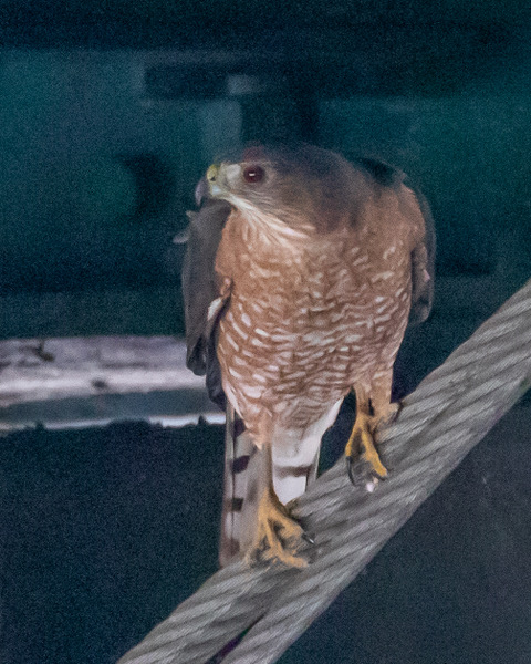
Link to Jan. 2025 trip report when we had 47 species, not bad for a spot surrounded by city and “freeway close.” Among the birds we’ve previously seen (and will look for again) are: Canada & Egyptian Geese, Blue-winged Teal & Ring-necked Duck, White-throated Swift, Anna’s and Allen’s Hummingbirds, 100’s of Black-necked Stilt, Spotted Sandpiper, Wilson’s Snipe, Greater & Lesser Yellowlegs, Black-crowned Night Heron (16 in one trailside tree!), egrets & herons, 4 raptor & 4 woodpecker species, Merlin, Lilac-crowned Amazon, and up to 25 species of flycatchers, sparrows, warblers and whatnots.
Date/Time: 10 January 2026, 8am
Location: Bette Davis Picnic Area, 1850 Riverside Drive, Glendale.
Reservations not needed. Questions? Contact: Chuck
Snacks & water might come in handy.
General Location: NW of intersection freeways I-5 & 134, NW Glendale, N of L.A. River, W of Riverside Drive. Park on Rancho Ave. There may be parking in a large dirt lot at the west end of the park where Rancho bends, but it might also be intended for horse trailers. Zoom in on the map.
Route thru San Fernando Valley: 24 miles from Santa Monica: I-10 east to I-405, 405 north to Ventura Fwy #101, east on Ventura Fwy which becomes #134, continue east on #134 to Riverside Drive/Victory* exit 5A, North (left) on Riverside Dr./Victory*, continue on Riverside as it bends left, left on Rancho Ave. Park car on Rancho. Note: The highway people are rebuilding the #405 in the Sepulveda pass on designated weekends (and this is a designated weekend) for the next few years, so you might want to check on drive times when using that route.
*Riverside Drive & Victory Blvd “overlap” when they cross the #134 freeway. Technically it’s Riverside but signs might say Victory. Be alert! [We need more lerts.]
Alternate route thru downtown LA: 25 miles from Santa Monica: I-10 east to #110, N. on 110 to I-5, NW on I-5 to North Zoo Drive exit 144A, right on N. Zoo Dr. to Zoo Dr., right on Zoo Dr. to Riverside Dr./Victory*, North (right) on Riverside Dr./Victory*, continue on Riverside as it bends left , left on Rancho Ave. Park car on Rancho.
On the blog there’s a Google map below here, but it might not show in your email.
Discover more from SANTA MONICA BAY AUDUBON SOCIETY BLOG
Subscribe to get the latest posts sent to your email.


