The Kelvin Wave: coming soon to a coast near you | L.A. Times
[Posted by Chuck Almdale]
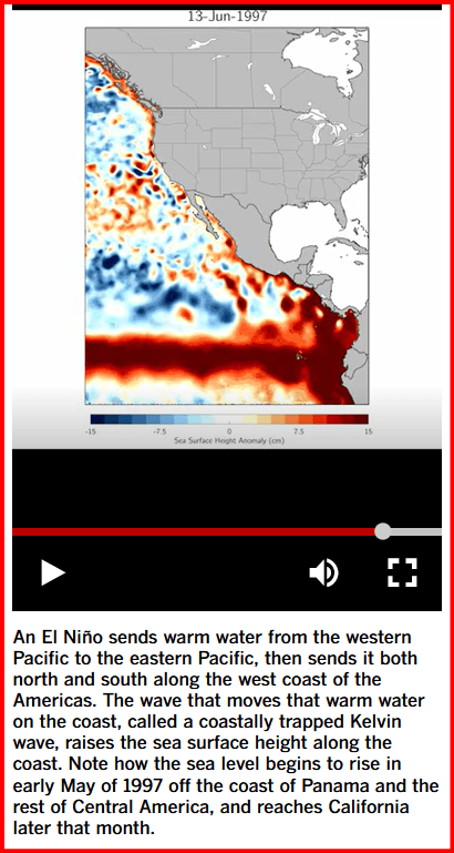
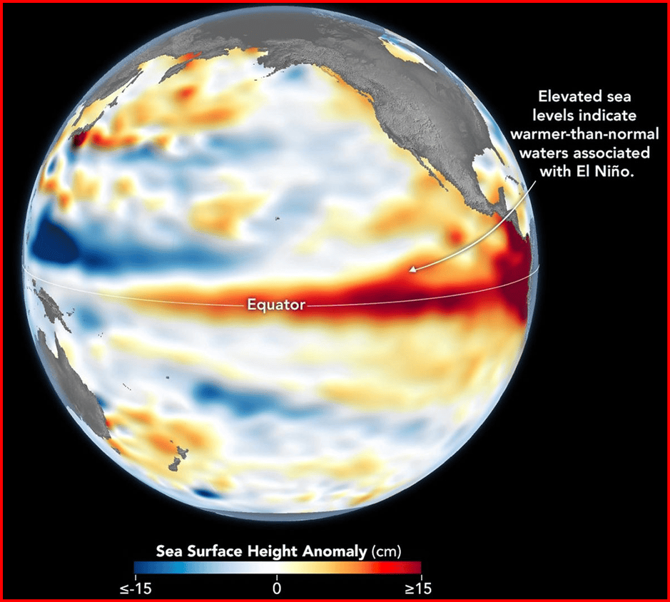
This wave, known as a “costally-trapped Kelvin wave,” is a key element of the El Niño weather condition. It is bringing warm equatorial water across the Pacific from Indonesia and the Indian Ocean and has already hit the Pacific Coast of South America. There, now “costally-trapped,” it split, sending water both south and north along the Pacific Coast of the Americas. The northbound section has already reached Mexico and is somewhere near Puerto Vallarta. SoCal sea level is expected to rise around six inches.
California coast braces for another battering as new El Niño-related wave emerges in Pacific
By Rong-Gong Lin II Staff Writer
Los Angeles Times | 10 Sept 2026 4:12 PM PT
[North Carolina State University assistant professor Dillon] Amaya said he expects the wave to enter the Gulf of California on or around Sept. 19. Once there, it’ll take around eleven days for the wave to hug the gulf’s U-shaped coast and, from there, another several for it to travel from the southernmost tip of the Baja California peninsula — Cabo San Lucas — to San Diego. It’ll then take about two to three days to reach L.A., another two to three more to get to San Francisco.
That would put the wave’s arrival in Southern California in early October, although the exact timing remains uncertain.
There was already a Kelvin wave earlier this year moving from the western North Pacific to the Gulf of Alaska from mid-May to mid-June. During the El Niño season of 2015-1 there were “five or six coastally trapped Kelvin waves that made their way up the coastline.” Hurricane season is not yet over and warm ocean water makes hurricane formation in the eastern Pacific more likely.
Link to: JPL Sea Level Mission satellite video graphic of warm water swell moving across Pacific March 2 – May 18, 2026.
Link to: NOAA Climate Prediction Center Report: ENSO: Recent Evolution, Current Status and Predictions
Link to: JPL Sea Level Isn’t Level scrolling video
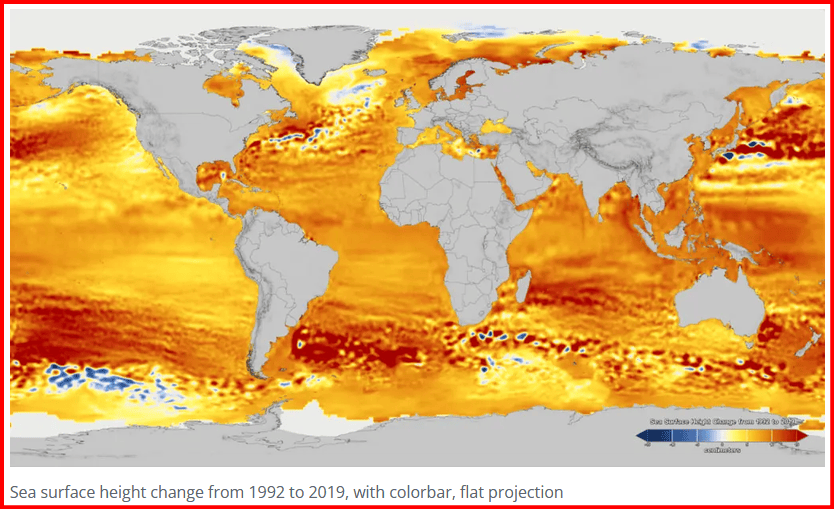
Link to: JPL 27-Year Sea Level Rise maps (example below)
Link to: NASA El Niño map below
Discover more from SANTA MONICA BAY AUDUBON SOCIETY BLOG
Subscribe to get the latest posts sent to your email.



Trackbacks