Ocean temperature contour maps | NOAA
[Posted by Chuck Almdale]
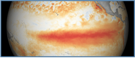
A few years ago, after a few thousand of our favorite jumping fish (Striped “Jumping” Mullet) died in Malibu Lagoon after many days of high heat and low O2 levels in the lagoon water, I posted a thermal map of the Pacific Ocean, as there was a local “hot blob” ocean temperature anomaly stretching up the SoCal coast from Baja to Santa Barbara. Here’s that map.
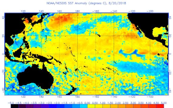
This particular map can be found on the NOAA site here.
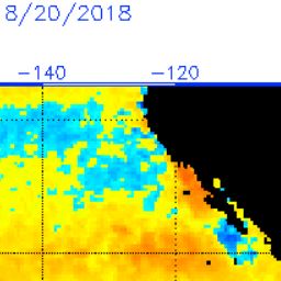
Many hundreds of maps for this and other “anomalies” for period 1996-2019 are available from NOAA here. Here’s a close-up of the map above, a bit pixelated.
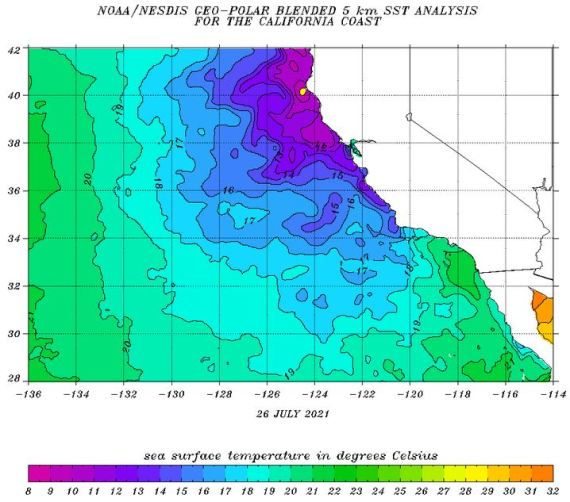
Dozens of temperature maps like these for at least sixteen areas are available daily from NOAA. Here’s one for roughly the same area for the most current day, Monday 26 July, 2021. There is no anomaly right now. Big difference, eh? Link to current day map.
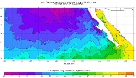
The next one focuses on the Gulf of California, 26 July 2021. Any blobs in our near future will most likely appear here first, then spread north.
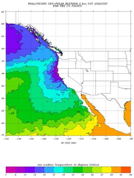
A wider-view one of the U.S. Pacific coast, 26 July 2021.
The entire world, below on 26 July 2021, found here.

The links to the maps above, except the 2018 anomaly map, will take you to the most recent day posted by NOAA.
Now that you know where to look, you can keep an eye out for any approaching fish-killing “blobs.” Let me know if you see one and we’ll post it here.
While we on the subject of ocean temperatures, here’s a page on El Niño from Pacific Marine Environmental Laboratory that will answer all your El Niño questions.
Why does El Niño occur?
El Niño results from interaction between the surface layers of the ocean and the overlying atmosphere in the tropical Pacific. It is the internal dynamics of the coupled ocean-atmosphere system that determine the onset and termination of El Niño events. The physical processes are complicated, but they involve unstable air-sea interaction and planetary-scale oceanic waves. The system oscillates between warm (El Niño) to neutral (or cold) conditions with a natural periodicity of roughly 3-4 years. External forcing from volcanic eruptions (submarine or terrestial) have no connnection with El Niño. Nor do sunspots as far as we know.
Two more useful maps
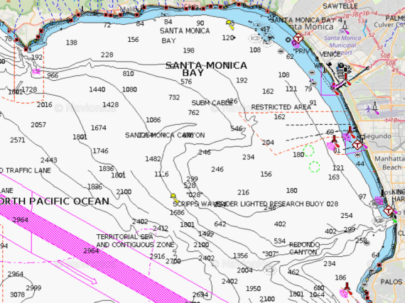
U.S. Fisherman’s map of Pacific Ocean
Shows depths, zoom in/out
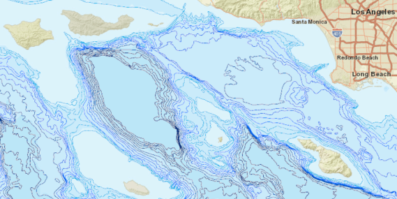
Database.org – 100 Meter depth contours
This map is capable of many interactive tricks
Discover more from SANTA MONICA BAY AUDUBON SOCIETY BLOG
Subscribe to get the latest posts sent to your email.


No wonder people surf Hawaii, high waves and warm(er) water!
Thanks for this new titbit on our planet! 🌲🐧🌲 c.prismon-reed 松林 songlin/ 송림 songlim ______________________________ * 詩人 小蘭 * “a poet is a small orchid”
On Tue, Jul 27, 2021, 14:21 SANTA MONICA BAY AUDUBON SOCIETY BLOG wrote:
> Chukar posted: ” [Posted by Chuck Almdale] A few years ago, after a few > thousand of our favorite jumping fish (Striped “Jumping” Mullet) died in > Malibu Lagoon after many days of high heat and low O2 levels in the lagoon > water, I posted a thermal map of the Pacific Oce” >
LikeLike
I think the fish die off in the Malibu Lagoon was due to the bulldozing of the area during the so called “restoration”.
I researched records as far back as I could find and there was never a massive die off before the bulldozing.
LikeLike
I disagree.
1. Fish die-off was 5 years after completion of restoration.
2. Previous lagoon formation was smaller and more shallow.
3. There were never anywhere near as many fish prior to restoration. Mullet were uncommon to rare.
4. No massive number of fish in lagoon means no massive fish die-off possible.
5. Mullet population grew to many thousand in 5 years following restoration.
6. Lagoon water temperature recorded just prior – during – after die off was high, several degrees above what Striped Mullet are report to be able to survive.
7. O2 dissolved in water is in inverse proportion to temp. of water.
8. Mullet were seen at water surface gulping air, like goldfish dying in their bowl.
9. August temps. were very high.
10. High temps in the oceanic “blob” meant that any water coming over or thru berm would also be warmer than usual.
In my opinion, the reconfiguration of the lagoon made the water more habitable, thus the large number of fish in the lagoon (until the heat struck and the O2 crashed).
LikeLike