Water II: rainfall, watershed, creek, lagoon, beach, ocean
[By Chuck Almdale]
The recent storm of October 21-23, 2026
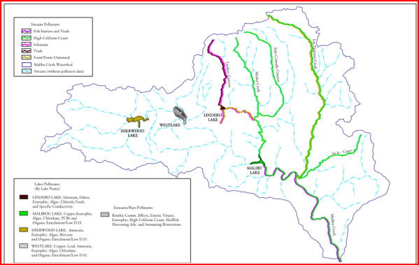
From Wednesday October 21 into Friday October 23, 2026, a moderate rain fell intermittently over SoCal. In the Malibu area the rainfall averaged 1.46 inches, varying between 1.26 – 1.67 inches, according to the chart I created below. The heaviest Malibu area rainfall was in Calabasas on Weds. 10/21 between 1 pm and 9 pm, when 1.01 inches fell during an eight-hour period.
The chart below shows what was recorded in the Malibu Creek watershed area.
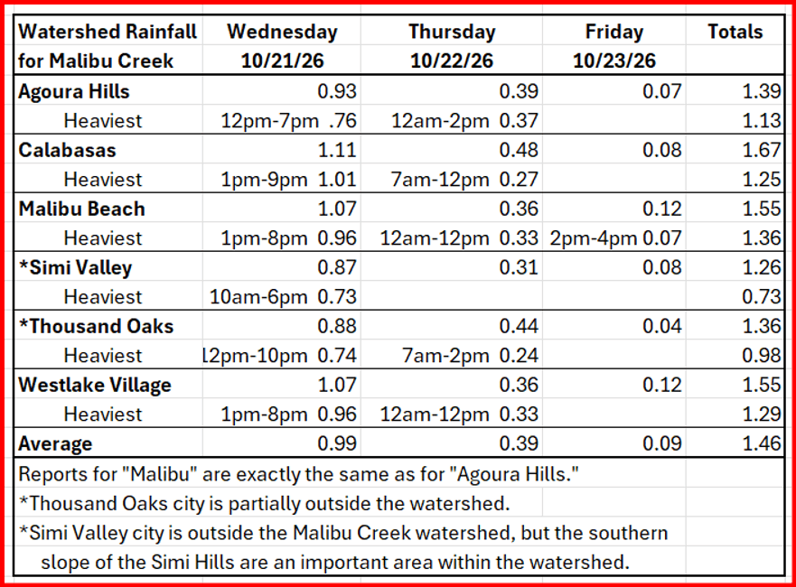
The above data came from the website Local Conditions, as of 10/29/26. Some minor changes from amounts posted two days earlier had occurred. Much of the watershed rainfall was outside the city limits of any of these towns, especially the large southern slope of the Simi Hills, drained by four creeks ( Las Virgenes, Palo Comado, Malibu, and Lindero) and their tributaries. Links to Local Conditions for the above communities is at the end of this article.
We also measured rainfall with our backyard rain gauge at our home in North Hills in the northern San Fernando Valley. Local Conditions does not report on this small neighborhood, but does report for Granada Hills, our western neighbor, located 1-3 miles from our home. Except for a three-hour downpour at our house the numbers are very close.
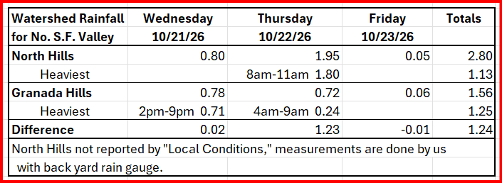
I don’t know why Local Conditions does not include 85% of the downpour we had on Thursday morning. Either cloudbursts can be extremely local and focused, or something was awry with their data collection system.
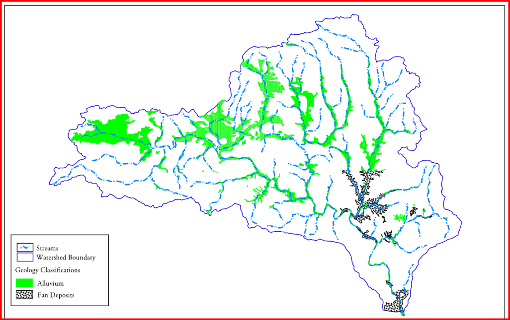
Page 16, figure 4 Stream Network and Associated Floodplain Malibu Creek Watershed
Just one of many interesting maps in this document.
The lagoon and beach on Sunday, October 25
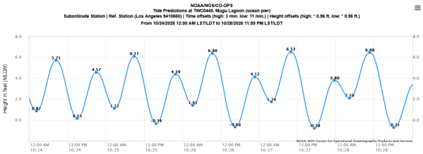
In my announcements for our monthly bird walk at Malibu Lagoon, I always mention the predicted tides and weather. The predicted tides come from the NOAA website, as below
We expected to see the worst when we arrived at the lagoon. What we found was rather peaceful, deceptively so.
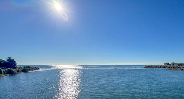
If you look closely at the photo above to the right of the sun’s reflection, you can see a the curl of a wave. And that’s about it. You might guess that the bottom is not far under that curl, but you can’t see it. You can’t see any beach damage, per se, because you can’t see any beach. The entire width of the beach from high point to high point had vanished, with barely a ripple remaining. That bushy-topped little cliff at the right (west) end, which we’ve seen in previous pictures, is about nine feet high and is normally 50-100 yards from the ocean. As I stood by the inland edge of that cliff (viewpoint 2 in map below) at 8 am on October 25, about 90 minutes before the above photo was taken, waves from the ocean were breaking inland of me, well into the lagoon. The high area on the left ( east side) is partially protected by the rocky rip-rap surrounding Adamson House, and there are plenty of boulders holding the cliff next to me in place, as best they could. This was the worst blowout/inundation I’d seen in 47 years, since I began censusing the lagoon birds in October 1979.
The aerial map below gives some reference points for the various photos that follows: the surf break link, viewpoint 2, the Adamson Boat House, the western Lifeguard Station, the location of the small bird flock until about 10am, and where Surfrider Beach ended at the riprap near Adamson House. Looking across the lagoon from viewpoint 2 towards the PCH bridge, I could see a small flock of Western Grebes, a species that is usually seen out past the surf zone, swimming and diving on the inland side of the bridge. Other than that, nothing on the water or lagoon edges, except for a small mixed flock of birds in the grassy verge of Adamson House property.
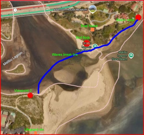
As the beach – if any beach remained anywhere – was completely submerged, I decided that for our usual 8:30 am bird walk instead of walking around the channels to the beach we would cross PCH, bird around the Adamson House property, and wait to see if the beach ever reappeared. A separate posting covers the details and sightings of that outing.
The following photos were taken roughly between 9:50 am – 10:15 am. High tide of 6.11 ft was at 8:51 am.
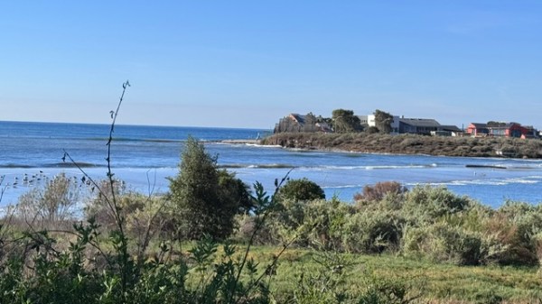
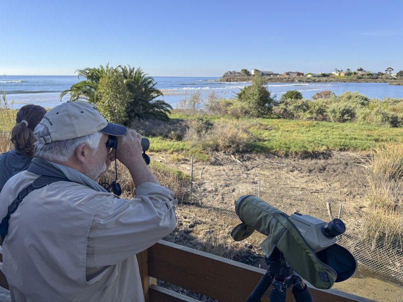
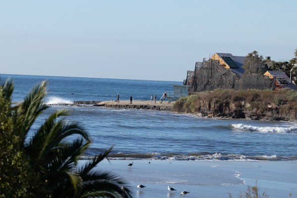
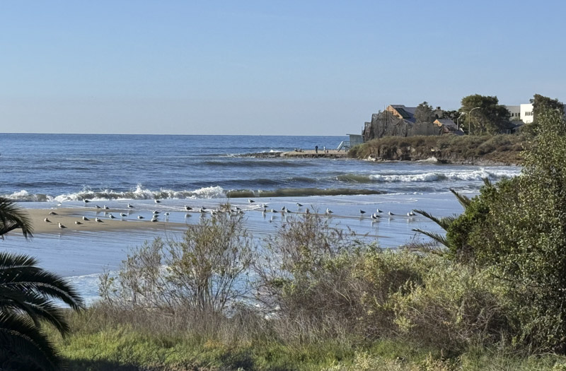
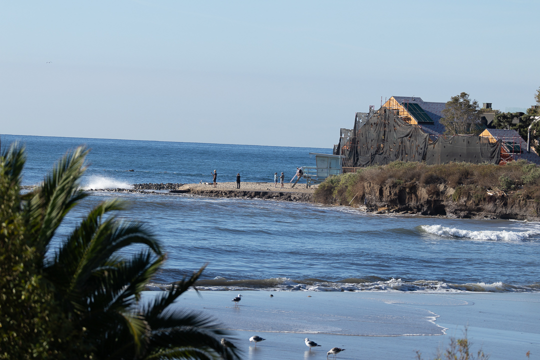
More and more sandy beach was appearing above the waves and the birds accumulated on the Adamson House vegetated shore were moving down to the exposed sand. We relocated to Surfrider Beach just east of Adamson House, hoping to be able to walk out onto the sand to get closer to the birds. But where this beach passes in front of Adamson House the sea was still up to the wall and fence around the property, although only an inch or two deep, except when a wave set rolled in. The exposed sand with birds was beyond this stretch and the fence prevented us from walking on the raised shoreline of the property. We left, crossed the PCH bridge, and some of us walked to the west side beach.
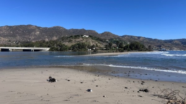
The next two photos were taken at the west side beach around 11am, roughly 2 hours after high tide. The wave break had moved offshore by this time.
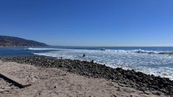
A month earlier, a channel about 20-30 yds long and 2 feet deep had been dug between the lagoon and the sea, no doubt under cover of darkness, as usual. It was deep enough so that when the tide was (approximately) 4 ft. or higher, waves could wash through it into the lagoon, but it was not low enough for the lagoon water to flow back out, even at low tide. This design might have been intentional, or accidental. Whichever, it served to maintain that particular location as the lowest potential breach point for any heavy rain coming down the creek as well as directing sediment at the westernmost wave break point. This struck me as very clever, or very lucky.
The exit channel shown below is exactly where that channel had been dug. We watched two teenagers wade eastward through the gap. The water was flowing out and they struggled a bit through the gap, with water waist-to-chest high at the deepest, but they made it, carrying their beach gear.
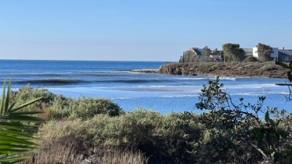
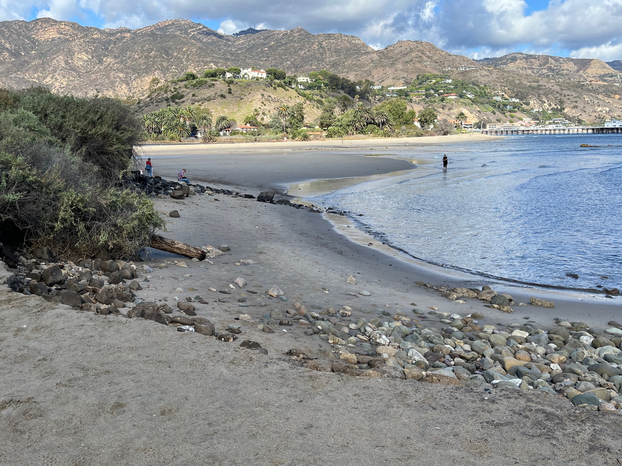
Two days earlier, on Friday October 23, the low tide was +0.75 at 2:27pm. The cliff in the following photo, taken 15 minutes earlier, is the same as in previous photos. Adamson House is the building directly across the lagoon just to the right of the foreground brushy cliff. Even at low tide, most of the beach has vanished during the rains.
Water I: Rainfall, watershed, beach erosion, Rindge Dam
Water II: Storm of October 21-23, 2026, lagoon and beach effects
Water III: The warming ocean
Appendix: Links to Local Conditions Cities
Sources for Local Conditions rainfall data in Malibu Creek watershed for October 21-23, 2026
Agoura Hills: https://www.localconditions.com/weather-agoura-hills-california/91301/past.php
Calabasas: https://www.localconditions.com/us/calabasas/california/weather/past/
Malibu Beach: https://www.localconditions.com/us/malibu-beach/california/weather/past/
Malibu: https://www.localconditions.com/us/malibu/california/weather/past/
Simi Valley: https://www.localconditions.com/us/simi-valley/california/weather/past/
Thousand Oaks: https://www.localconditions.com/us/thousand-oaks/california/weather/past/
Westlake Village: https://www.localconditions.com/us/westlake-village/california/weather/past/
Discover more from SANTA MONICA BAY AUDUBON SOCIETY BLOG
Subscribe to get the latest posts sent to your email.